Missions & Projects
For further mission information, data, research, and other resources, see the Cryospheric Sciences Projects.
Featured
Alphabetical
By Last Name:
Displaying records 1 to 14 of 14.
Show:
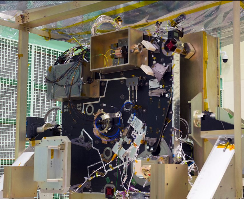
Advanced Topographic Laser Altimeter System (ATLAS)
ICESat-2 carries a single instrument – the Advanced Topographic Laser Altimeter System, or ATLAS. Like the altimeter on the first ICESat mission, ATLAS measures the travel times of laser pulses to calculate the distance between the spacecraft and Earth’s surface. ATLAS features new technologies that allow it to collect a more detailed, precise picture of the heights of the planet’s ice, vegetation, land surface, water and clouds. As it orbits over the poles, ATLAS has three major tasks: Send pulses of laser light to the ground, collect the returning photons in a telescope, and record the photon travel time.
Aqua
Aqua, Latin for water, is a NASA satellite mission designed to collect information about Earth's water cycle and other aspects of the Earth system. Aqua's six instruments collect a variety of global data on ocean evaporation, atmospheric water vapor, clouds, precipitation, soil moisture, sea ice, land ice, and snow cover on the land and ice. Additional variables that Aqua measures include radiative energy fluxes; aerosols; vegetation cover on the land; phytoplankton and dissolved organic matter in the oceans; and air, land, and water temperatures. Aqua was launched on May 4, 2002.
Key Staff
- Project Scientist: Lazaros Oreopoulos
- Deputy Project Scientist: Linette Boisvert
Clouds and the Earth’s Radiant Energy System (CERES)
The Clouds and the Earth’s Radiant Energy System (CERES) project provides satellite-based observations of ERB and clouds. It uses measurements from CERES instruments flying on several satellites along with data from many other instruments to produce a comprehensive set of ERB data products for climate, weather and applied science research.
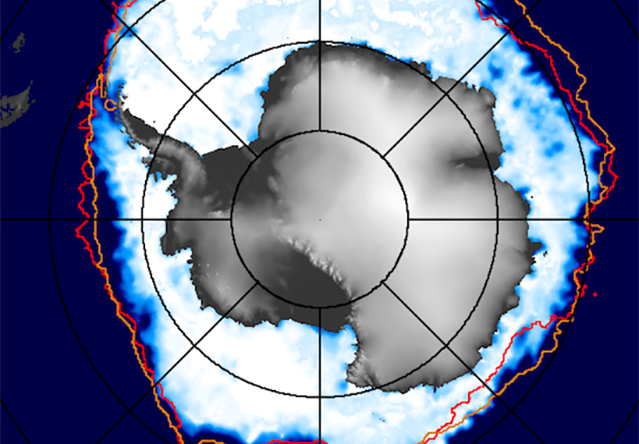
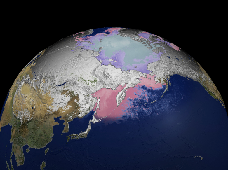
Current State of Sea Ice Cover
Up-to-date satellite observations of the sea ice covers of both the Arctic and the Antarctic, along with comparisons with the historical satellite record of more than 4 decades.
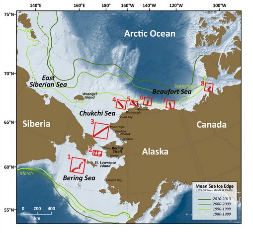
Distributed Biological Observatory (DBO)
Distributed Biological Observatory (DBO) is a multi-agency program in support of the NOAA Arctic Research Program. Here we present data imagery and animations displaying recent chlorophyll pigment concentration, sea surface temperatures, sea ice concentration, cloud fraction, wind vectors, and sea level pressure.
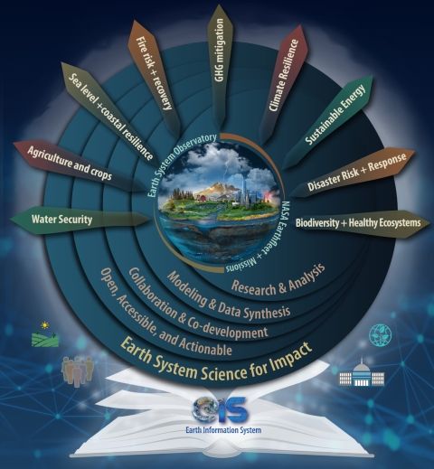
Earth Information System (EIS)
The Earth Information System (EIS) is a transdisciplinary, collaborative research and applications activity that combines NASA's satellite observations with modeling capabilities to produce new, integrated information enabled by emerging technology.
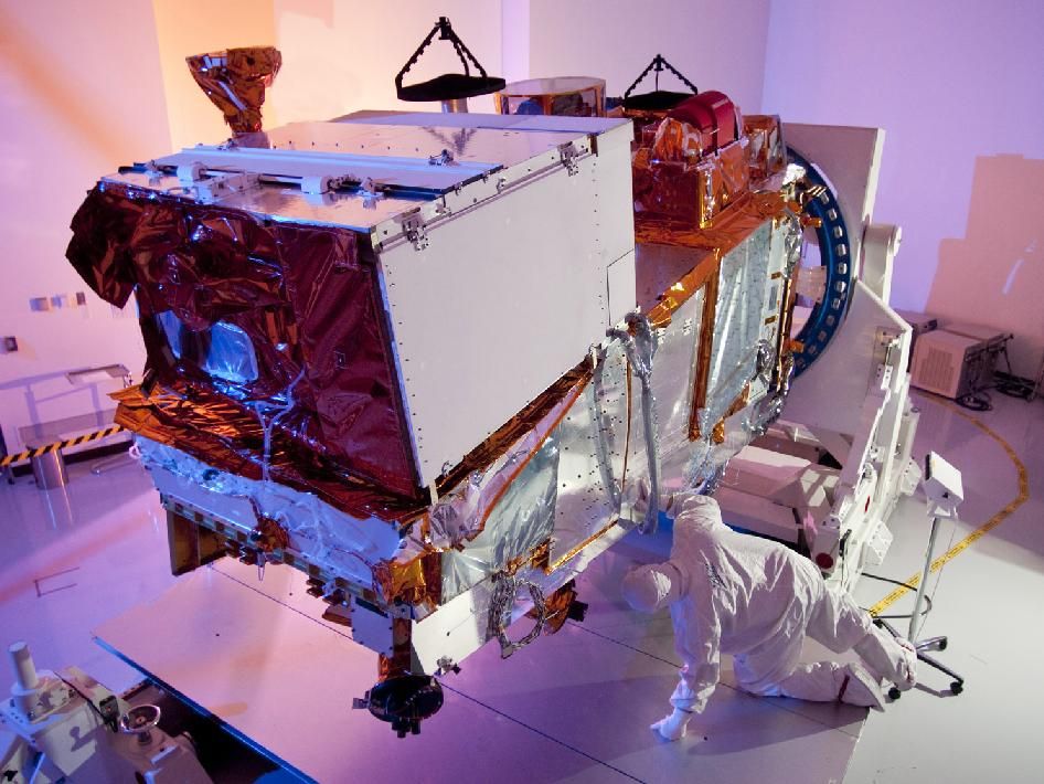
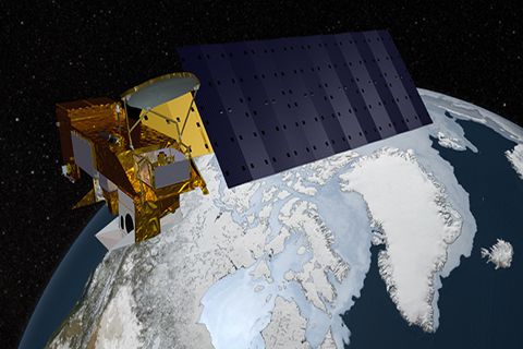
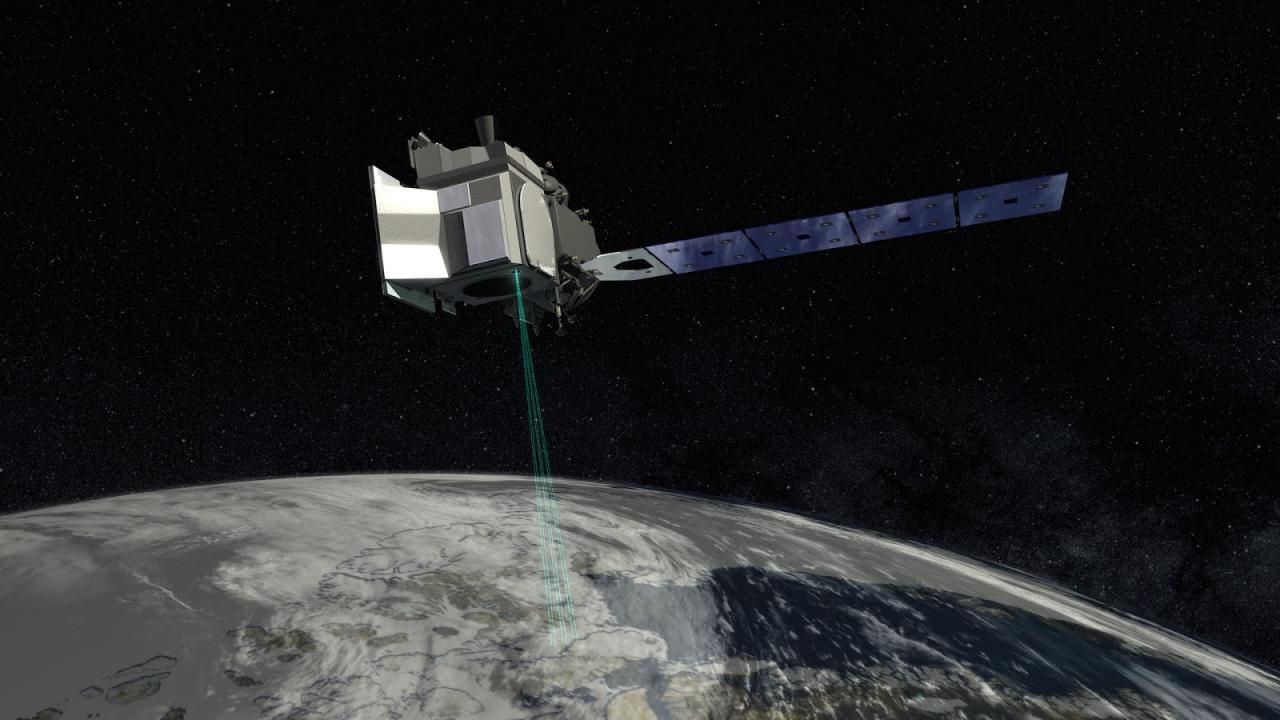
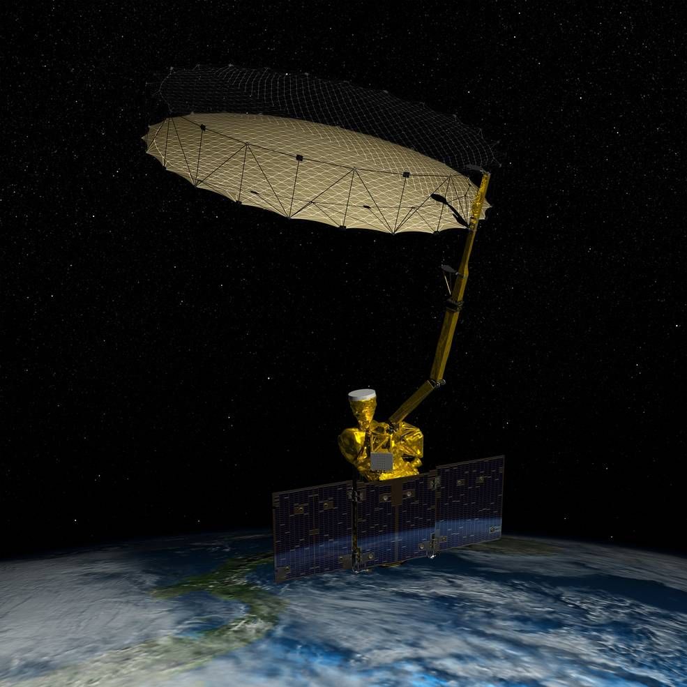
ICESat 2: Ice, Cloud, and Land Elevation Satellite 2 (ICESat-2)
The Ice, Cloud, and Land Elevation Satellite-2, or ICESat-2, measures the height of a changing Earth, one laser pulse at a time, 10,000 laser pulses a second. Launched September 15, 2018, ICESat-2 carries a photon-counting laser altimeter that allows scientists to measure the elevation of ice sheets, glaciers, sea ice and more - all in unprecedented detail.
Key Staff
- Support Scientist: Stephen Holland
- Receiver Algorithms Lead: Jan Mcgarry
- Senior Support Scientist: Scott Luthcke
- Calibration Team Member: Philip Dabney
- Sr. Test Systems Engineer: Henock Legesse
- Project Scientist: Thomas Neumann
- Deputy Project Scientist: Nathan Kurtz
- Instrument Scientist: Anthony Martino
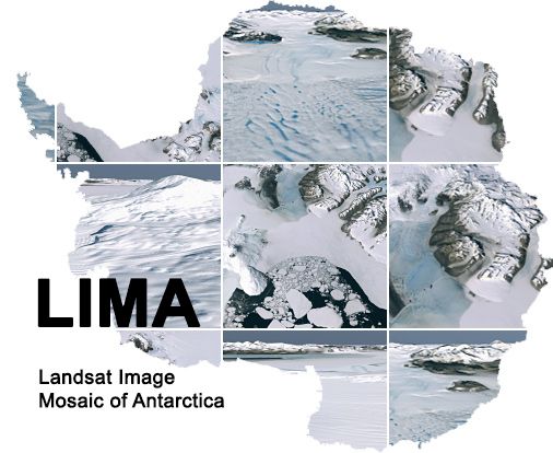
Landsat Image Mosaic of Antarctica (LIMA)
The Landsat Image Mosaic of Antarctica (LIMA) is the first-ever true-color high-resolution satellite view of the Antarctic continent, enabling you to see Antarctica as it would really appear if you were hovering above it.
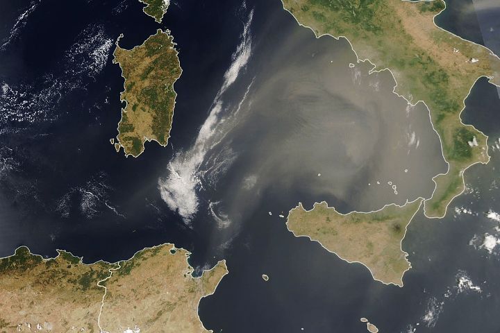
Moderate Resolution Imaging Spectroradiometer (MODIS)
MODIS (or Moderate Resolution Imaging Spectroradiometer) is a key instrument aboard the Terra (originally known as EOS AM-1) and Aqua (originally known as EOS PM-1) satellites. Terra's orbit around the Earth is timed so that it passes from north to south across the equator in the morning, while Aqua passes south to north over the equator in the afternoon. Terra MODIS and Aqua MODIS are viewing the entire Earth's surface every 1 to 2 days, acquiring data in 36 spectral bands, or groups of wavelengths (see MODIS Technical Specifications). These data will improve our understanding of global dynamics and processes occurring on the land, in the oceans, and in the lower atmosphere. MODIS is playing a vital role in the development of validated, global, interactive Earth system models able to predict global change accurately enough to assist policy makers in making sound decisions concerning the protection of our environment.
Moderate Resolution Imaging Spectroradiometer Snow/Ice (MODIS S/I)
The Moderate Resolution Imaging Spectroradiometer (MODIS) is a 36-channel visible to thermal-infrared sensor that was first launched as part of the Earth Observing System (EOS) Terra payload on 18 December 1999. A second MODIS was launched as part of the payload on the Aqua satellite on May 4, 2002. A variety of snow and ice products is produced from the MODIS sensors, and the products are available at a variety of spatial and temporal resolutions. The MODIS snow product suite begins with a 500-m resolution, 2330-km swath snow-cover map which is then gridded to a sinusoidal grid. The sequence proceeds to climate-modeling grid (CMG) products on a latitude/longitude (cylindrical equidistant projection). Most of the products are archived at the National Snow and Ice Data Center (NSIDC) in Boulder, CO.
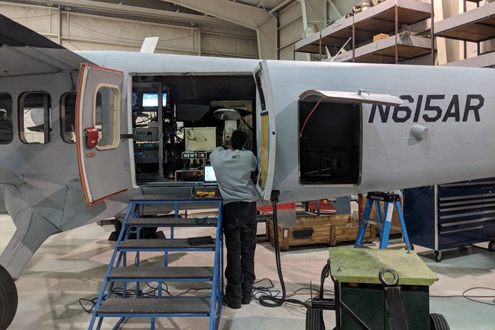
Snow Water Equivalent SAR and Radiometer (SWESARR)
The Snow Water Equivalent Synthetic Aperture Radar and Radiometer (SWESARR) is a new instrument designed to measure the water content in a snowpack. The instrument, developed at NASA’s Goddard Space Flight Center, uses active and passive microwave sensors to map the radio frequency emissions of the snowpack, which can then be turned into a measurement of snow water equivalent.
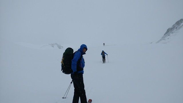
SnowEx
SnowEx is a five year program initiated and funded by NASA's Terrestrial Hydrology Program to address the most important gaps in snow remote sensing knowledge. It focuses on airborne campaigns and field work, and on comparing the various sensing technologies, from the mature to the more experimental, in globally-representative types of snow. The goal is to address the most important gaps in our snow remote sensing knowledge, and thus lay the groundwork for a future snow satellite mission.
Soil Moisture Active-Passive Mission (SMAP)
The Soil Moisture Active Passive (SMAP) mission is an orbiting observatory that measures the amount of water in the surface soil everywhere on Earth. It was launched in January 2015 and started operation in April 2015. The SMAP radiometer has been operating flawlessly. The radar instrument, ceasing operation in early 2015 due to failure of radar power supply, collected close to 3 months of science data. The prime mission phase of three years was completed in 2018, and since then SMAP has been in extended operation phase.
Key Staff
- Calibration Team Member: Emmanuel Dinnat
- Applications Coordinator: Molly Brown
- Science Team Member: Rolf Reichle
- Deputy Project Scientist: Rajat Bindlish
Visible Infrared Imaging Radiometer Suite (VIIRS)
The Visible Infrared Imaging Radiometer Suite (VIIRS) instrument collects visible and infrared imagery and global observations of land, atmosphere, cryosphere and oceans. Currently flying on the Suomi NPP and NOAA-20 satellite missions, VIIRS generates many critical environmental products about snow and ice cover, clouds, fog, aerosols, fire, smoke plumes, dust, vegetation health, phytoplankton abundance, and chlorophyll. VIIRS will also be on the JPSS-3 and JPSS-4 satellites.